
Deda topographic map
Click on the map to display elevation.
About this map
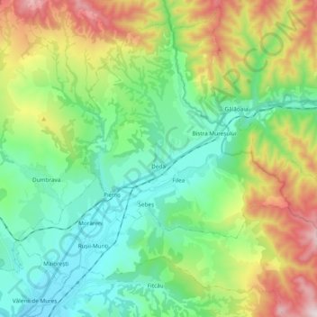
Name: Deda topographic map, elevation, terrain.
Location: Deda, Mureș, Romania (46.88811 24.82665 47.01307 25.01558)
Average elevation: 675 m
Minimum elevation: 410 m
Maximum elevation: 1,259 m
Other topographic maps
Click on a map to view its topography, its elevation and its terrain.