
Thank you for supporting this site ❤️
Make a donation
Make a donation
Gear up for your next adventure:
As an Amazon Associate, this site earns from qualifying purchases at no extra cost to you.
Srisailam topographic map
Click on the map to display elevation.
Thank you for supporting this site ❤️
Make a donation
Make a donation
Gear up for your next adventure:
As an Amazon Associate, this site earns from qualifying purchases at no extra cost to you.
About this map
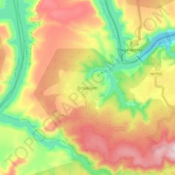
Name: Srisailam topographic map, elevation, terrain.
Location: Srisailam, Nandyal, Andhra Pradesh, 518100, India (16.03378 78.83271 16.11378 78.91271)
Average elevation: 437 m
Minimum elevation: 165 m
Maximum elevation: 712 m
Thank you for supporting this site ❤️
Make a donation
Make a donation
Gear up for your next adventure:
As an Amazon Associate, this site earns from qualifying purchases at no extra cost to you.