
Barre City topographic map
Interactive map
Click on the map to display elevation.
About this map
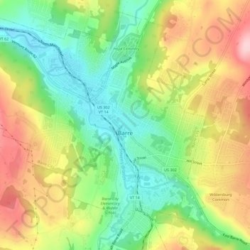
Name: Barre City topographic map, elevation, terrain.
Location: Barre City, Washington County, Vermont, 05641, United States (44.18014 -72.53836 44.21619 -72.48283)
Average elevation: 262 m
Minimum elevation: 172 m
Maximum elevation: 375 m
Other topographic maps
Click on a map to view its topography, its elevation and its terrain.
South Cabot
United States > Vermont > Washington County > Cabot > South Cabot
Average elevation: 480 m