
Thank you for supporting this site ❤️
Make a donation
Make a donation
Gear up for your next adventure:
As an Amazon Associate, this site earns from qualifying purchases at no extra cost to you.
Rubial topographic map
Click on the map to display elevation.
Thank you for supporting this site ❤️
Make a donation
Make a donation
Gear up for your next adventure:
As an Amazon Associate, this site earns from qualifying purchases at no extra cost to you.
About this map
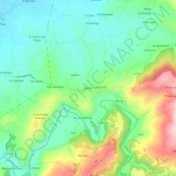
Name: Rubial topographic map, elevation, terrain.
Location: Rubial, Calvor, Sarria, Lugo, Galicia, 27610, Spain (42.75351 -7.38632 42.79351 -7.34632)
Average elevation: 487 m
Minimum elevation: 411 m
Maximum elevation: 639 m
Thank you for supporting this site ❤️
Make a donation
Make a donation
Gear up for your next adventure:
As an Amazon Associate, this site earns from qualifying purchases at no extra cost to you.