
Loran topographic map
Interactive map
Click on the map to display elevation.
About this map
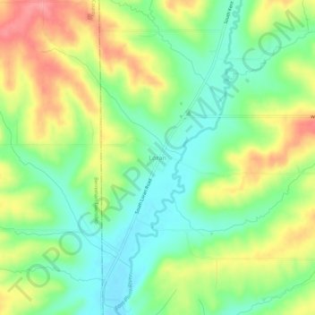
Name: Loran topographic map, elevation, terrain.
Location: Loran, Stephenson County, Illinois, États-Unis d'Amérique (42.21502 -89.93040 42.25502 -89.89040)
Average elevation: 256 m
Minimum elevation: 215 m
Maximum elevation: 313 m