
Toton Washlands topographic map
Interactive map
Click on the map to display elevation.
About this map
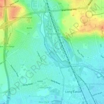
Name: Toton Washlands topographic map, elevation, terrain.
Average elevation: 42 m
Minimum elevation: 29 m
Maximum elevation: 71 m
Other topographic maps
Click on a map to view its topography, its elevation and its terrain.
Moorgreen
United Kingdom > England > Broxtowe > Moorgreen
Moorgreen, Broxtowe, Nottinghamshire, East Midlands, England, NG16 2FB, United Kingdom
Average elevation: 105 m