
Naabsiegenhofen topographic map
Interactive map
Click on the map to display elevation.
About this map
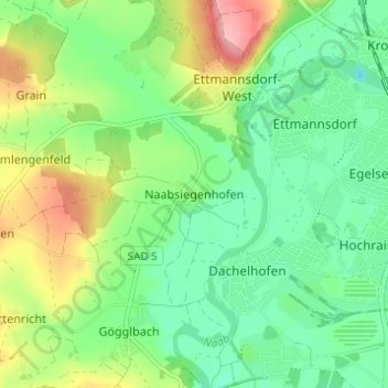
Name: Naabsiegenhofen topographic map, elevation, terrain.
Average elevation: 372 m
Minimum elevation: 329 m
Maximum elevation: 453 m
Other topographic maps
Click on a map to view its topography, its elevation and its terrain.
Klardorf
Deutschland > Bayern > Landkreis Schwandorf > Schwandorf
Klardorf, Schwandorf, Landkreis Schwandorf, Bayern, 93158, Deutschland
Average elevation: 359 m