
Rio topographic map
Interactive map
Click on the map to display elevation.
About this map
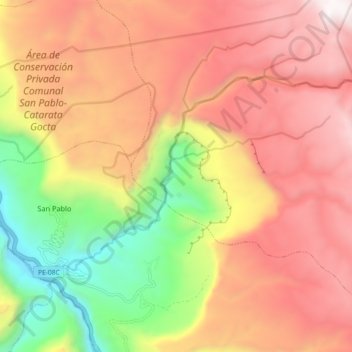
Name: Rio topographic map, elevation, terrain.
Location: Rio, San Carlos, Provincia de Bongará, Amazonas, Perú (-6.05983 -77.92344 -6.00887 -77.83314)
Average elevation: 2,455 m
Minimum elevation: 1,409 m
Maximum elevation: 3,287 m
Other topographic maps
Click on a map to view its topography, its elevation and its terrain.
Catarata del Gocta
Perú > Amazonas > San Carlos
Catarata del Gocta, San Carlos, Provincia de Bongará, Amazonas, Perú
Average elevation: 2,460 m
San Carlos
Perú > Amazonas > San Carlos
San Carlos, Provincia de Bongará, Amazonas, Perú
Average elevation: 2,624 m