Geolocate

Sn2 topographic map

Click on the map to display elevation.

About this map
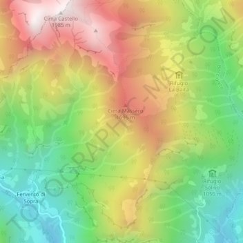
Name: Sn2 topographic map, elevation, terrain.

Location: Sn2, Boccioleto, Vercelli, Piedmont, 13022, Italy (45.83878 8.08743 45.85878 8.10743)

Average elevation: 1,290 m

Minimum elevation: 723 m

Maximum elevation: 1,964 m

Gear up for your next adventure:

📦Compression Sacks - Reduce backpack volume efficiently
📕Outdoor Navigation Books - Learn traditional and modern navigation techniques
📱Rugged Phone Cases - Heavy-duty protection for smartphones used as secondary GPS tools
🧢Waterproof Hiking Hats - Keep the rain off your face while studying topographic maps
🪢Paracord - Multi-purpose cord for camping and survival

As an Amazon Associate, this site earns from qualifying purchases at no extra cost to you.