
Thủy Nguyên District topographic map
Interactive map
Click on the map to display elevation.
About this map
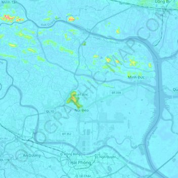
Name: Thủy Nguyên District topographic map, elevation, terrain.
Location: Thủy Nguyên District, Hải Phòng, Vietnam (20.86344 106.55462 21.02029 106.77070)
Average elevation: 5 m
Minimum elevation: -7 m
Maximum elevation: 196 m
Other topographic maps
Click on a map to view its topography, its elevation and its terrain.