Geolocate

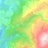
Girabolhos topographic map

Click on the map to display elevation.

About this map

Name: Girabolhos topographic map, elevation, terrain.

Location: Girabolhos, Seia, Guarda, Portugal (40.48216 -7.78564 40.53552 -7.71969)

Average elevation: 393 m

Minimum elevation: 192 m

Maximum elevation: 507 m

Other topographic maps

Click on a map to view its topography, its elevation and its terrain.
Serra da Estrela

Portugal > Guarda > Seia

Average elevation: 1,825 m

Senhora do Desterro

Portugal > Guarda > Seia

Average elevation: 830 m

Paranhos da Beira

Portugal > Guarda > Seia

Average elevation: 379 m

Gear up for your next adventure:

🦯Walking Poles - Supportive poles for long-distance walking
🥫Expedition Meals - Lightweight, high-calorie nutrition for long-distance hikers
🧼Biodegradable Soap - Leave-no-trace hygiene for multi-day mountain treks
🛌Insulated Sleeping Mats - Crucial thermal protection when sleeping on cold, uneven ground
🛰️Satellite Messengers - Emergency communication devices for areas without mobile signal

As an Amazon Associate, this site earns from qualifying purchases at no extra cost to you.