Geolocate

Kagwe topographic map

Click on the map to display elevation.

About this map

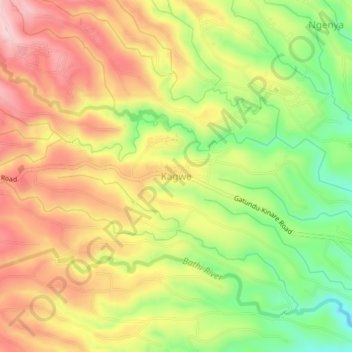
Name: Kagwe topographic map, elevation, terrain.

Location: Kagwe, Kiambu, Central Kenya, Kenya (-1.02438 36.72392 -0.98438 36.76392)

Average elevation: 2,047 m

Minimum elevation: 1,918 m

Maximum elevation: 2,161 m

Gear up for your next adventure:

🗺️Ordnance Survey Maps - Official UK maps for walking and outdoor activities
🧤Waterproof Overmitts - Extreme weather protection for hikers and mountaineers
🪢Paracord - Multi-purpose cord for camping and survival
🥾Walking Shoes - Lightweight walking shoes for countryside and coastal paths
📻Hand-Crank Emergency Radios - Stay updated on weather warnings in remote areas

As an Amazon Associate, this site earns from qualifying purchases at no extra cost to you.