
Foggaret Ezzaouia topographic map
Interactive map
Click on the map to display elevation.
About this map
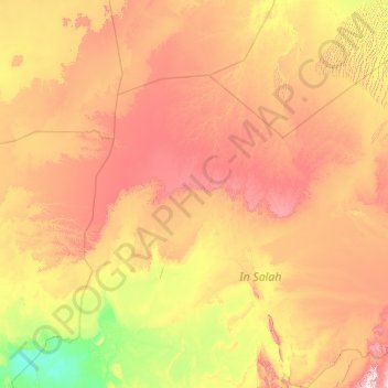
Name: Foggaret Ezzaouia topographic map, elevation, terrain.
Location: Foggaret Ezzaouia, d'In Salah District, In Salah, Algeria (26.17924 2.71565 29.75830 5.77701)
Average elevation: 422 m
Minimum elevation: 119 m
Maximum elevation: 1,157 m
Foggaret Ezzoua lies at an elevation of 305 metres (1,001 ft) on a dry plain in the Sahara. The town is located just to the east of an oasis; separated by a line of sand dunes.