
Pothukal topographic map
Interactive map
Click on the map to display elevation.
About this map
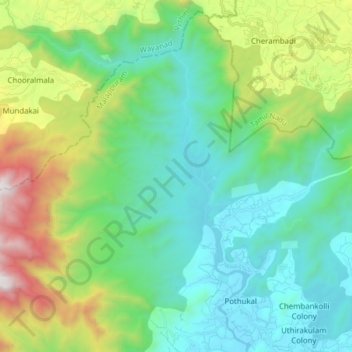
Name: Pothukal topographic map, elevation, terrain.
Location: Pothukal, Nilambur, Malappuram, Kerala, 679354, India (11.38671 76.13876 11.52928 76.29387)
Average elevation: 561 m
Minimum elevation: 29 m
Maximum elevation: 2,084 m