
Manaung topographic map
Interactive map
Click on the map to display elevation.
About this map
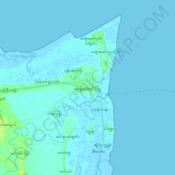
Name: Manaung topographic map, elevation, terrain.
Location: Manaung, Manaung Township, Kyaukpyu District, Rakhine, Myanmar (18.81465 93.68766 18.89465 93.76766)
Average elevation: 1 m
Minimum elevation: -3 m
Maximum elevation: 13 m