
Birbouche topographic map
Interactive map
Click on the map to display elevation.
About this map
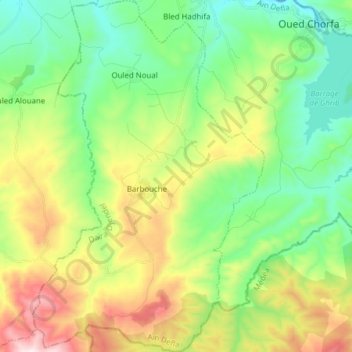
Name: Birbouche topographic map, elevation, terrain.
Location: Birbouche, Djendel District, Aïn Defla, Algeria (36.04911 2.43342 36.17383 2.53498)
Average elevation: 619 m
Minimum elevation: 366 m
Maximum elevation: 1,109 m