Geolocate

Wind Point topographic map

Click on the map to display elevation.

About this map
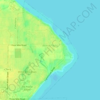
Name: Wind Point topographic map, elevation, terrain.

Location: Wind Point, Racine County, Wisconsin, United States (42.76993 -87.78201 42.79642 -87.75560)

Average elevation: 181 m

Minimum elevation: 174 m

Maximum elevation: 191 m

Other topographic maps

Click on a map to view its topography, its elevation and its terrain.

Franksville

United States > Wisconsin > Racine County > Caledonia

Average elevation: 226 m

Gear up for your next adventure:

⛺Lightweight Tents - Compact tents for backpacking and trekking
🧣Neck Gaiters - Protects against wind and sun on exposed ridges and peaks
🌦️Portable Weather Meters - Handheld tools for monitoring weather conditions
🥾Hiking Boot Waterproofing Wax - Maintain the lifespan of your leather trekking boots
🥾Walking Shoes - Lightweight walking shoes for countryside and coastal paths

As an Amazon Associate, this site earns from qualifying purchases at no extra cost to you.