Geolocate

Slapper topographic map

Click on the map to display elevation.

About this map

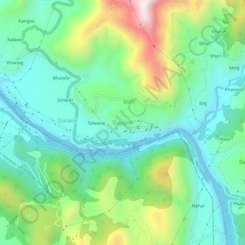
Name: Slapper topographic map, elevation, terrain.

Location: Slapper, Sundarnagar, Mandi, Himachal Pradesh, 175017, India (31.39501 76.84200 31.43501 76.88200)

Average elevation: 720 m

Minimum elevation: 499 m

Maximum elevation: 1,261 m

Gear up for your next adventure:

🌂Windproof Trekking Umbrellas - Surprising but effective rain protection on low-wind trails
🕶️Polarized Sunglasses - Reduces glare from snow and water when reading terrain
🧭GPS Trackers - Tracking devices for safety and navigation
📕Outdoor Navigation Books - Learn traditional and modern navigation techniques
🛰️Outdoor GPS Navigation - Navigation devices for remote and off-grid areas

As an Amazon Associate, this site earns from qualifying purchases at no extra cost to you.