Kea topographic map
Click on the map to display elevation.
Kea
Its capital, Ioulis, is inland at a high altitude (like most ancient Cycladic settlements, for fear of pirates) and is considered quite picturesque. Other major villages of Kea are the port of Korissia and the fishing village of Vourkari. After suffering depopulation for many decades, Kea has been recently rediscovered by Athenians as a convenient destination for weekend and yachting trips. The population in 2019 was 2,568.
About this map
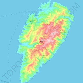
Name: Kea topographic map, elevation, terrain.
Average elevation: 81 m
Minimum elevation: 0 m
Maximum elevation: 565 m
Other topographic maps
Click on a map to view its topography, its elevation and its terrain.