
天等县 topographic map
Interactive map
Click on the map to display elevation.
About this map
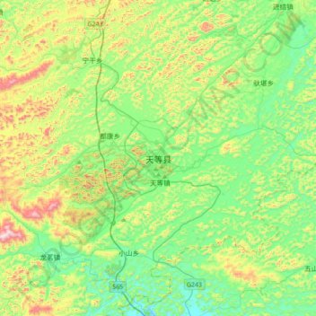
Name: 天等县 topographic map, elevation, terrain.
Location: 天等县, 崇左市, 广西壮族自治区, 中国 (22.92324 106.97937 23.24324 107.29937)
Average elevation: 504 m
Minimum elevation: 294 m
Maximum elevation: 995 m
Other topographic maps
Click on a map to view its topography, its elevation and its terrain.