
Beïda Bordj topographic map
Interactive map
Click on the map to display elevation.
About this map
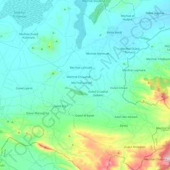
Name: Beïda Bordj topographic map, elevation, terrain.
Location: Beïda Bordj, Ain Azal District, Setif, Algeria (35.75111 5.57573 35.92412 5.75704)
Average elevation: 1,016 m
Minimum elevation: 878 m
Maximum elevation: 1,650 m