
Thank you for supporting this site ❤️
Make a donation
Make a donation
Gear up for your next adventure:
As an Amazon Associate, this site earns from qualifying purchases at no extra cost to you.
Liex topographic map
Click on the map to display elevation.
Thank you for supporting this site ❤️
Make a donation
Make a donation
Gear up for your next adventure:
As an Amazon Associate, this site earns from qualifying purchases at no extra cost to you.
About this map
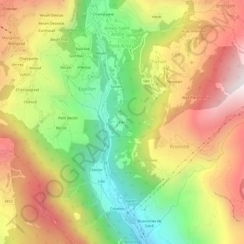
Name: Liex topographic map, elevation, terrain.
Location: Liex, Epaillon, Antey-Saint-André, Aosta Valley, 11020, Italy (45.76982 7.57400 45.80982 7.61400)
Average elevation: 1,327 m
Minimum elevation: 703 m
Maximum elevation: 1,977 m
Thank you for supporting this site ❤️
Make a donation
Make a donation
Gear up for your next adventure:
As an Amazon Associate, this site earns from qualifying purchases at no extra cost to you.