
Grottham topographic map
Interactive map
Click on the map to display elevation.
About this map
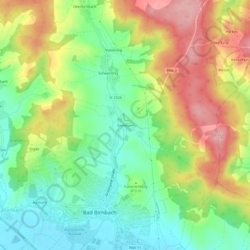
Name: Grottham topographic map, elevation, terrain.
Average elevation: 416 m
Minimum elevation: 348 m
Maximum elevation: 507 m
Other topographic maps
Click on a map to view its topography, its elevation and its terrain.
Nindorf
Deutschland > Bayern > Landkreis Rottal-Inn > Bad Birnbach > Hirschbach
Nindorf, Hirschbach, Bad Birnbach, Bad Birnbach (VGem), Landkreis Rottal-Inn, Bayern, 84364, Deutschland
Average elevation: 389 m
Naßberg
Deutschland > Bayern > Landkreis Rottal-Inn > Bad Birnbach > Lengham > Naßberg
Naßberg, Lengham, Bad Birnbach, Bad Birnbach (VGem), Landkreis Rottal-Inn, Bayern, 94137, Deutschland
Average elevation: 374 m