
Refugi Ventosa i Calvell topographic map
Interactive map
Click on the map to display elevation.
About this map
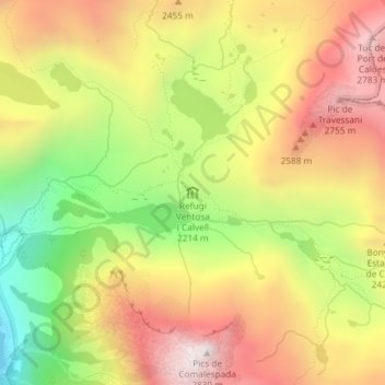
Name: Refugi Ventosa i Calvell topographic map, elevation, terrain.
Average elevation: 2,334 m
Minimum elevation: 1,777 m
Maximum elevation: 2,820 m
Other topographic maps
Click on a map to view its topography, its elevation and its terrain.
Refugi d'Estany Llong
Espagne > Catalogne > Lérida > la Vall de Boí
Refugi d'Estany Llong, Camí d'Aigüestortes a l'Estany de Sant Maurici, la Vall de Boí, Haute-Ribagorce, Lérida, Catalogne, Espagne
Average elevation: 2,228 m