
Murung Raya topographic map
Interactive map
Click on the map to display elevation.
Murung Raya
The regency has an area of 23,700 km2 and lies between 114°27'00 to 115°49'00 East longitude and 0°58'30 North latitude to 1°26'00 South latitude. It occupies the valleys and foothills of the southern and eastern slopes of the Müller Mountains, and rises to 1730 m at Mount Lesung on its northern border. Most of the riverine area lies at an altitude of 100 to 200 m above sea level while the foothills are mostly at an altitude of 400–500 m.
About this map
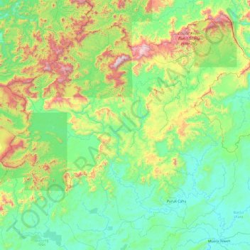
Name: Murung Raya topographic map, elevation, terrain.
Location: Murung Raya, Central Kalimantan, Kalimantan, Indonesia (-0.92849 113.21934 0.79101 115.13739)
Average elevation: 365 m
Minimum elevation: 16 m
Maximum elevation: 1,857 m
Other topographic maps
Click on a map to view its topography, its elevation and its terrain.