
Hulu Sungai Utara topographic map
Interactive map
Click on the map to display elevation.
About this map
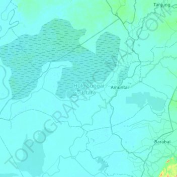
Name: Hulu Sungai Utara topographic map, elevation, terrain.
Location: Hulu Sungai Utara, South Kalimantan, Kalimantan, Indonesia (-2.55463 114.85873 -2.29386 115.39965)
Average elevation: 10 m
Minimum elevation: 0 m
Maximum elevation: 329 m
Other topographic maps
Click on a map to view its topography, its elevation and its terrain.