
Simeulue topographic map
Interactive map
Click on the map to display elevation.
About this map
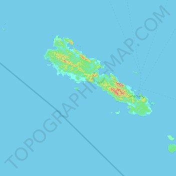
Name: Simeulue topographic map, elevation, terrain.
Location: Simeulue, Aceh, 23891, Indonesien (2.05782 95.38586 3.01790 96.68852)
Average elevation: 6 m
Minimum elevation: -2 m
Maximum elevation: 561 m
Other topographic maps
Click on a map to view its topography, its elevation and its terrain.
Burni Telong
Burni Telong, Timang Gajah, Bener Meriah, Aceh, Indonesien
Average elevation: 2,032 m
Geureudong
Geureudong, Gajah Putih, Bener Meriah, Aceh, Indonesien
Average elevation: 2,558 m