Geolocate

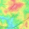
Cherokee Forest topographic map

Click on the map to display elevation.

About this map

Name: Cherokee Forest topographic map, elevation, terrain.

Location: Cherokee Forest, Athens, Clarke County, Georgia, 30601, United States (33.99317 -83.38932 34.03317 -83.34932)

Average elevation: 217 m

Minimum elevation: 180 m

Maximum elevation: 257 m

Other topographic maps

Click on a map to view its topography, its elevation and its terrain.
Sandy Creek Park

United States > Georgia > Clarke County > Athens

Average elevation: 219 m

Memorial Park

United States > Georgia > Clarke County > Athens

Average elevation: 209 m

Gear up for your next adventure:

⛺Camping Shelters - Emergency and lightweight shelters for outdoor use
🌄Outdoor Binoculars - Compact binoculars for landscape observation
🧭Emergency Beacons - Safety beacons for remote outdoor locations
🧣Neck Gaiters - Versatile protection against wind and cold
🧦Hiking Socks - Breathable socks designed to prevent blisters on long walks

As an Amazon Associate, this site earns from qualifying purchases at no extra cost to you.