
Thank you for supporting this site ❤️
Make a donation
Make a donation
Gear up for your next adventure:
As an Amazon Associate, this site earns from qualifying purchases at no extra cost to you.
Hochstadt topographic map
Click on the map to display elevation.
Thank you for supporting this site ❤️
Make a donation
Make a donation
Gear up for your next adventure:
As an Amazon Associate, this site earns from qualifying purchases at no extra cost to you.
About this map
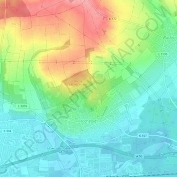
Name: Hochstadt topographic map, elevation, terrain.
Location: Hochstadt, Maintal, Main-Kinzig-Kreis, Hesse, 63477, Germany (50.14267 8.81296 50.17578 8.85703)
Average elevation: 136 m
Minimum elevation: 98 m
Maximum elevation: 205 m
Thank you for supporting this site ❤️
Make a donation
Make a donation
Gear up for your next adventure:
As an Amazon Associate, this site earns from qualifying purchases at no extra cost to you.
Other topographic maps
Click on a map to view its topography, its elevation and its terrain.