Geolocate

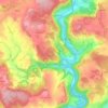
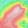
Cwmcarvan topographic map

Click on the map to display elevation.

About this map

Name: Cwmcarvan topographic map, elevation, terrain.

Location: Cwmcarvan, Monmouthshire, Wales, NP25 4JP, United Kingdom (51.74399 -2.78009 51.78399 -2.74009)

Average elevation: 133 m

Minimum elevation: 31 m

Maximum elevation: 262 m

Other topographic maps

Click on a map to view its topography, its elevation and its terrain.
Llanbadoc

United Kingdom > Wales > Monmouthshire

Average elevation: 78 m

Wye Valley

United Kingdom > Wales > Monmouthshire

Average elevation: 167 m

Penallt

United Kingdom > Wales > Monmouthshire

Average elevation: 174 m

Crucorney

United Kingdom > Wales > Monmouthshire

Average elevation: 297 m

Blorenge

United Kingdom > Wales > Monmouthshire > Govilon

Average elevation: 394 m

River Monnow

United Kingdom > Wales > Monmouthshire

Average elevation: 172 m

River Monnow

United Kingdom > Wales > Monmouthshire

Average elevation: 172 m

Raglan Castle

United Kingdom > Wales > Monmouthshire > Raglan

Average elevation: 59 m

Gear up for your next adventure:

🧗Locking Carabiners - Secure gear to your pack or for light technical use
🧼Technical Clothing Wash - Special soap to clean and restore waterproof membranes
👖Packable Overtrousers - Quick-deploy rain protection for legs in sudden storms
🍱Food Containers - Reusable containers for outdoor meals
🧣Neck Gaiters - Versatile protection against wind and cold

As an Amazon Associate, this site earns from qualifying purchases at no extra cost to you.