Geolocate

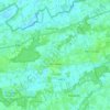
Werkstede topographic map

Click on the map to display elevation.

About this map

Name: Werkstede topographic map, elevation, terrain.

Location: Werkstede, Lokeren, Sint-Niklaas, East Flanders, Flanders, 9160, Belgium (51.09821 3.95180 51.13821 3.99180)

Average elevation: 4 m

Minimum elevation: -3 m

Maximum elevation: 8 m

Other topographic maps

Click on a map to view its topography, its elevation and its terrain.
Moerbeke

Belgium > East Flanders > Sint-Niklaas > Lokeren

Average elevation: 3 m

Gear up for your next adventure:

🦟Anti-Midge & Tick Repellent - Vital for hiking in the Scottish Highlands during summer
🗺️Ordnance Survey Maps - Essential paper maps for hiking across the UK national parks
🥤Hiking Water Bottles - Reusable bottles for hydration on the trail
☕Insulated Travel Mugs - Keep drinks hot while surveying the landscape from a summit
🧰First Aid Kits - Essential safety kits for outdoor activities

As an Amazon Associate, this site earns from qualifying purchases at no extra cost to you.