Geolocate

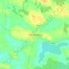
Derrywode topographic map

Click on the map to display elevation.

About this map

Name: Derrywode topographic map, elevation, terrain.

Location: Derrywode, Island ED, Ballinasloe Municipal District, County Galway, Connacht, Ireland (53.68189 -8.56242 53.69595 -8.53377)

Average elevation: 77 m

Minimum elevation: 62 m

Maximum elevation: 98 m

Other topographic maps

Click on a map to view its topography, its elevation and its terrain.
Gear up for your next adventure:

🔦Keychain LED Torches - Emergency backup light for finding gear in your pack
🧭Professional Hiking Compasses - High-precision liquid-filled compasses for map reading and orientation
📱Phone Mounts for Hiking - Secure mounts to carry your phone on trails
🛰️Outdoor GPS Navigation - Navigation devices for remote and off-grid areas
🥾Hiking Boot Waterproofing Wax - Maintain the lifespan of your leather trekking boots

As an Amazon Associate, this site earns from qualifying purchases at no extra cost to you.