Geolocate

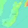
Grassy Narrows topographic map

Click on the map to display elevation.

About this map

Name: Grassy Narrows topographic map, elevation, terrain.

Location: Grassy Narrows, Unorganized Division No. 18 (East), Manitoba, Canada (51.05785 -96.86307 51.07785 -96.84307)

Average elevation: 216 m

Minimum elevation: 214 m

Maximum elevation: 221 m

Other topographic maps

Click on a map to view its topography, its elevation and its terrain.
Gear up for your next adventure:

🌂Windproof Trekking Umbrellas - Surprising but effective rain protection on low-wind trails
📢Survival Whistles - Essential safety gear for signaling for help in mountain fog
❄️Walking Crampons - Added traction for icy slopes and winter peak bagging
🧰Survival Kits - Emergency tools for remote environments
⛺Lightweight Tents - Compact tents for backpacking and trekking

As an Amazon Associate, this site earns from qualifying purchases at no extra cost to you.