
Upper Padley topographic map
Interactive map
Click on the map to display elevation.
About this map
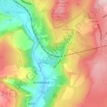
Name: Upper Padley topographic map, elevation, terrain.
Average elevation: 264 m
Minimum elevation: 125 m
Maximum elevation: 405 m
Other topographic maps
Click on a map to view its topography, its elevation and its terrain.
Yarncliff Wood
United Kingdom > England > Derbyshire > Derbyshire Dales > Grindleford
Yarncliff Wood, Grindleford, Derbyshire Dales, Derbyshire, East Midlands, England, United Kingdom
Average elevation: 260 m
Longshaw Estate
United Kingdom > England > Derbyshire > Derbyshire Dales > Grindleford > Upper Padley
Longshaw Estate, B6521, Upper Padley, Grindleford, Derbyshire Dales, Derbyshire, England, S32 2JA, United Kingdom
Average elevation: 303 m