Geolocate

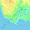
Newton topographic map

Click on the map to display elevation.

About this map

Name: Newton topographic map, elevation, terrain.

Location: Newton, Bridgend County Borough, Wales, CF36 5DS, United Kingdom (51.46546 -3.69634 51.50546 -3.65634)

Average elevation: 29 m

Minimum elevation: -1 m

Maximum elevation: 105 m

Bridgend County Borough trails, hiking, mountain biking, running and outdoor activities

Other topographic maps

Click on a map to view its topography, its elevation and its terrain.

Newton

United Kingdom > Wales > Bridgend County Borough > Newton

Average elevation: 22 m

Gear up for your next adventure:

👖Hiking Trousers - Durable trousers designed for rough terrain
🔭Compact Hiking Binoculars - Lightweight optics for scouting terrain and spotting wildlife
👖Packable Overtrousers - Quick-deploy rain protection for legs in sudden storms
👕Technical Hiking Tees - Moisture-management for high-exertion climbs
🧷Tenacious Repair Tape - Instant fix for torn tents, jackets, or dry bags

As an Amazon Associate, this site earns from qualifying purchases at no extra cost to you.