
Huntingburg topographic map
Interactive map
Click on the map to display elevation.
About this map
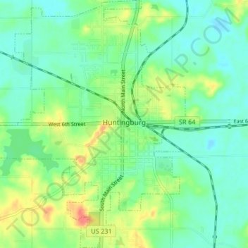
Name: Huntingburg topographic map, elevation, terrain.
Average elevation: 148 m
Minimum elevation: 130 m
Maximum elevation: 187 m
Other topographic maps
Click on a map to view its topography, its elevation and its terrain.
Jasper
États-Unis d'Amérique > Indiana > Dubois County > Jasper
Jasper, Dubois County, Indiana, 47546, États-Unis d'Amérique
Average elevation: 150 m