
Mabaruma - Kumaka - Hosororo topographic map
Interactive map
Click on the map to display elevation.
Mabaruma - Kumaka - Hosororo
Mabaruma is the administrative centre and regional capital for Region One (Barima-Waini) of Guyana. It is located close to the Aruka River (the Venezuelan border) on a narrow plateau above the surrounding rainforest at an elevation of 13 metres.
About this map
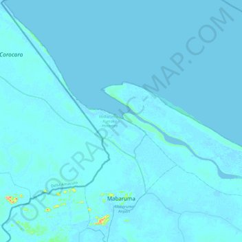
Name: Mabaruma - Kumaka - Hosororo topographic map, elevation, terrain.
Average elevation: 2 m
Minimum elevation: -2 m
Maximum elevation: 140 m
Other topographic maps
Click on a map to view its topography, its elevation and its terrain.