Geolocate

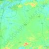
Linxu topographic map

Click on the map to display elevation.

About this map

Name: Linxu topographic map, elevation, terrain.

Location: Linxu, Nanning, Guangxi, China (23.48333 108.09106 23.56333 108.17106)

Average elevation: 247 m

Minimum elevation: 169 m

Maximum elevation: 480 m

Other topographic maps

Click on a map to view its topography, its elevation and its terrain.

Xixiangtang District

China > Guangxi > Nanning

Average elevation: 130 m

Heng County

China > Guangxi > Nanning

Average elevation: 135 m

Xingning District

China > Guangxi > Nanning

Average elevation: 191 m

Qingxiu District

China > Guangxi > Nanning

Average elevation: 140 m

Liangqing

China > Guangxi > Nanning

Average elevation: 98 m

Yongning District

China > Guangxi > Nanning

Average elevation: 118 m

Long'an County

China > Guangxi > Nanning

Average elevation: 255 m

Gear up for your next adventure:

👕Merino Base Layers - Natural temperature regulation for cold weather hiking and camping
💧Hydration Reservoirs - Convenient water bladders for hands-free drinking on the move
🎒Hiking Daypacks (20L) - Compact backpacks for day trips and technical mountain ascents
🧘Folding Sit Mats - Dry and warm seat for map-reading breaks on damp ground
🧥Breathable Waterproof Jackets - Essential rain protection for the unpredictable British climate

As an Amazon Associate, this site earns from qualifying purchases at no extra cost to you.