
Blackbird Hill topographic map
Interactive map
Click on the map to display elevation.
About this map
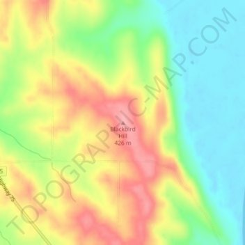
Name: Blackbird Hill topographic map, elevation, terrain.
Location: Blackbird Hill, Thurston County, Nebraska, United States (42.07994 -96.29869 42.08004 -96.29859)
Average elevation: 369 m
Minimum elevation: 318 m
Maximum elevation: 427 m
Other topographic maps
Click on a map to view its topography, its elevation and its terrain.