Brakel topographic map
Click on the map to display elevation.
Brakel
Brakel's Hanseatic roots go back to its early history and stretch through the Middle Ages. From the first written reference to "villa brechal" in 836 (in connection with transferring Saint Vitus's bones from Saint Denis, France, to Corvey) through to the 12th century, when it was the seat of the Lords of Brakel, the town found itself centrally located by virtue of two old commercial roads that crossed here. Moreover, the topography made expansion possible in the Early Middle Ages.
About this map
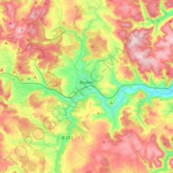
Name: Brakel topographic map, elevation, terrain.
Location: Brakel, Kreis Höxter, North Rhine-Westphalia, 33034, Germany (51.62778 9.06318 51.79796 9.28667)
Average elevation: 232 m
Minimum elevation: 104 m
Maximum elevation: 365 m
Other topographic maps
Click on a map to view its topography, its elevation and its terrain.