Geolocate

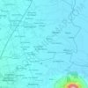
Parang topographic map

Click on the map to display elevation.

About this map

Name: Parang topographic map, elevation, terrain.

Location: Parang, Concepcion, Tarlac, Central Luzon, 2301, Philippines (15.39173 120.62931 15.43173 120.66931)

Average elevation: 36 m

Minimum elevation: 27 m

Maximum elevation: 58 m

Other topographic maps

Click on a map to view its topography, its elevation and its terrain.
Parua River

Philippines > Tarlac > Concepcion

Average elevation: 43 m

Gear up for your next adventure:

🦶Anti-Blister Balms - Protect your feet before long topographic expeditions
👖Convertible Hiking Trousers - Versatile zip-off pants for changing mountain weather conditions
🥾Trekking Poles - Poles to improve stability on uneven terrain
🌦️Portable Weather Meters - Handheld tools for monitoring weather conditions
🥫Expedition Meals - Lightweight, high-calorie nutrition for long-distance hikers

As an Amazon Associate, this site earns from qualifying purchases at no extra cost to you.