
Cahas Mountain topographic map
Interactive map
Click on the map to display elevation.
About this map
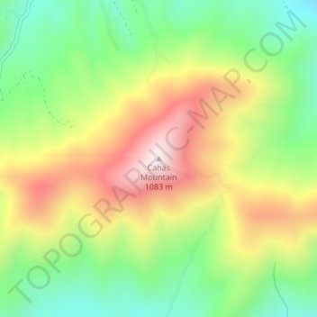
Name: Cahas Mountain topographic map, elevation, terrain.
Location: Cahas Mountain, Franklin County, Virginia, United States (37.11731 -80.01564 37.11741 -80.01554)
Average elevation: 755 m
Minimum elevation: 511 m
Maximum elevation: 1,061 m
Other topographic maps
Click on a map to view its topography, its elevation and its terrain.