
Rosenkogel topographic map
Interactive map
Click on the map to display elevation.
About this map
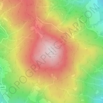
Name: Rosenkogel topographic map, elevation, terrain.
Location: Rosenkogel, Deutschlandsberg, Styria, Austria (46.89550 15.14863 46.89560 15.14873)
Average elevation: 1,140 m
Minimum elevation: 893 m
Maximum elevation: 1,353 m