Geolocate

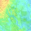
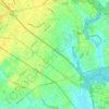
Tall PInes topographic map

Click on the map to display elevation.

About this map

Name: Tall PInes topographic map, elevation, terrain.

Location: Tall PInes, Berkeley County, South Carolina, 29456, United States (32.99017 -80.12537 33.03017 -80.08537)

Average elevation: 13 m

Minimum elevation: 2 m

Maximum elevation: 23 m

Other topographic maps

Click on a map to view its topography, its elevation and its terrain.
Ladson

United States > South Carolina > Berkeley County

Average elevation: 14 m

Ladson

United States > South Carolina > Berkeley County

Average elevation: 14 m

Gear up for your next adventure:

⛺Camping Shelters - Emergency and lightweight shelters for outdoor use
🔦Head Torches - Hands-free lighting for hiking and camping
🧰First Aid Kits - Essential safety kits for outdoor activities
🥤Collapsible Water Bottles - Save space in your rucksack as you consume your water
🥾Hiking Boot Waterproofing Wax - Maintain the lifespan of your leather trekking boots

As an Amazon Associate, this site earns from qualifying purchases at no extra cost to you.