
Głogów Małopolski topographic map
Interactive map
Click on the map to display elevation.
About this map
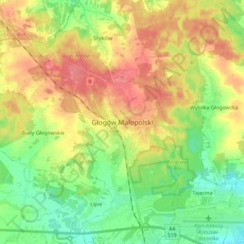
Name: Głogów Małopolski topographic map, elevation, terrain.
Average elevation: 225 m
Minimum elevation: 196 m
Maximum elevation: 259 m
Other topographic maps
Click on a map to view its topography, its elevation and its terrain.
Dział
Poland > Subcarpathian Voivodeship > Rzeszów County > Piątkowa
Dział, Piątkowa, gmina Błażowa, Rzeszów County, Subcarpathian Voivodeship, 36-035, Poland
Average elevation: 337 m
Boguchwała
Poland > Subcarpathian Voivodeship > Rzeszów County
Boguchwała, gmina Boguchwała, Rzeszów County, Subcarpathian Voivodeship, 36-040, Poland
Average elevation: 218 m