Geolocate

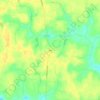
Jarratt topographic map

Click on the map to display elevation.

About this map

Name: Jarratt topographic map, elevation, terrain.

Location: Jarratt, Sussex County, Virginia, United States (36.80486 -77.48593 36.82644 -77.45668)

Average elevation: 47 m

Minimum elevation: 36 m

Maximum elevation: 52 m

Other topographic maps

Click on a map to view its topography, its elevation and its terrain.
Yale

United States > Virginia > Sussex County

Average elevation: 31 m

Homeville

United States > Virginia > Sussex County

Average elevation: 30 m

Gear up for your next adventure:

🥾Hiking Boots - Waterproof and durable boots for long-distance hiking in the UK
🧦Hiking Socks - Breathable socks designed to prevent blisters on long walks
🧭Emergency Beacons - Safety beacons for remote outdoor locations
🥫Expedition Meals - Lightweight, high-calorie nutrition for long-distance hikers
👖Convertible Hiking Trousers - Versatile zip-off pants for changing mountain weather conditions

As an Amazon Associate, this site earns from qualifying purchases at no extra cost to you.