
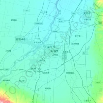
吴忠市 topographic map
Interactive map
Click on the map to display elevation.
About this map
Name: 吴忠市 topographic map, elevation, terrain.
Location: 吴忠市, 金星, 利通区, 吴忠市, 宁夏回族自治区, 中国 (37.83708 106.03431 38.15708 106.35431)
Average elevation: 1,135 m
Minimum elevation: 1,108 m
Maximum elevation: 1,369 m
吴忠市位于宁夏回族自治区中部,南接中卫,北连银川,东部与陕西省定边县毗邻,东北,西北与内蒙古自治区的伊克昭盟和阿拉善左旗相连,东南与甘肃庆阳地区接壤。吴忠市东西长而南北窄,地势南高北低,北为银川平原,南为青铜峡平原和丘陵山地。平原海拔1100米,山区海拔在1300—1900米。