
Ketti topographic map
Interactive map
Click on the map to display elevation.
About this map
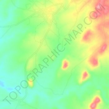
Name: Ketti topographic map, elevation, terrain.
Location: Ketti, Municipal Area Council, Federal Capital Territory, Nigeria (8.87583 7.35833 8.91583 7.39833)
Average elevation: 369 m
Minimum elevation: 324 m
Maximum elevation: 433 m