
West Branch topographic map
Interactive map
Click on the map to display elevation.
About this map
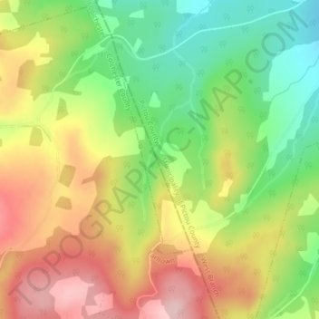
Name: West Branch topographic map, elevation, terrain.
Location: West Branch, Colchester County, Nouvelle-Écosse, Canada (45.61261 -63.08661 45.62869 -63.07784)
Average elevation: 186 m
Minimum elevation: 79 m
Maximum elevation: 300 m