
Grüntensee topographic map
Interactive map
Click on the map to display elevation.
About this map
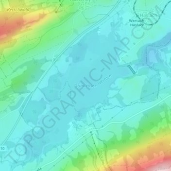
Name: Grüntensee topographic map, elevation, terrain.
Average elevation: 917 m
Minimum elevation: 862 m
Maximum elevation: 1,135 m
Other topographic maps
Click on a map to view its topography, its elevation and its terrain.
Faistenoy
Deutschland > Bayern > Landkreis Oberallgäu > Faistenoy
Faistenoy, Oy-Mittelberg, Landkreis Oberallgäu, Bayern, 87466, Deutschland
Average elevation: 935 m